Eclipse Path
|
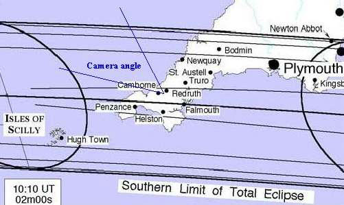
This map shows the path of the region of totality across Cornwall. The oval regions on the left and right are the locations of the moon's core shadow at 11:10 and 11:15 BST (by coincidence, the first location corresponds approximately to the first image of the Totality Sequence (50 sec before totality)).
(this image was derived (with kind permission) from a map calculated and published by Fred Espenak (NASA/GSFC))
|